
คู่มือการเดินทาง
ค้นหาสถานที่สำคัญ จุดท้องถิ่น แผนที่ สภาพอากาศ และเคล็ดลับการเดินทางสำหรับครีต
กำลังมองหา สิ่งที่ต้องทำในครีต? คู่มือนี้ช่วยเปรียบเทียบแหล่งท่องเที่ยว ไฮไลท์ท้องถิ่น แผนที่ และสภาพอากาศเพื่อวางแผนการเดินทางของคุณให้ลงตัว.
ครีตเป็นเกาะที่ใหญ่ที่สุดของกรีซ มีโบราณสถานตั้งแต่อยุคหินใหม่จนถึงยุคมีนอย ผสมกับภูเขาหินสูง ที่ราบเพาะปลูก และแอ่งทะเลสาบชายฝั่งสีฟ้า หากคุณกำลังค้นหา สิ่งที่ต้องทำในครีต คุณจะพบทั้งแหล่งโบราณคดี ช่องเขาที่ตระการตา ชายหาดเป็นมิตรกับครอบครัว และหมู่บ้านแบบดั้งเดิม.
ทุกจุดต้องการการวางแผนเล็กน้อยเพราะขนาดเกาะและภูมิประเทศที่หลากหลาย.

ทำไมควรมาที่ครีต
ครีตรวมโบราณสถานชั้นยอด ทิวทัศน์ธรรมชาติหลากหลาย และวัฒนธรรมชนบทที่ยังมีชีวิต เรื่องเด่นอย่างพระราชวังคโนซอสและพิพิธภัณฑ์โบราณคดีเฮรัคลิออนเป็นแกนหลักสำหรับผู้ที่สนใจอารยธรรมยุคแรกของยุโรป.
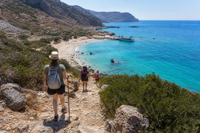
นักท่องเที่ยวเชิงธรรมชาติจะพบการเดินเท้าระยะยาว (เช่น Samaria Gorge) ชายฝั่งที่งดงาม (Balos, Elafonissi) และทริปเรือไปเกาะเล็กๆ เช่น Spinalonga ขณะที่หมู่บ้านแบบดั้งเดิม ไม้ประทับ ไร่องุ่น และน้ำมันมะกอก รวมถึงอาหารครีตช่วยให้ผสมผสานการผจญภัยในภูเขากับการพักผ่อนริมทะเลได้ในทริปเดียว.

สิ่งที่ต้องทำในครีต
ครีตรวมโบราณคดีระดับโลก ช่องเขาและชายฝั่งที่โดดเด่น นี่คือไฮไลท์ของเกาะพร้อมคำแนะนำเชิงปฏิบัติสำหรับการเยี่ยมชมแต่ละจุด
Palace of Knossos (Heraklion)
The Palace of Knossos is the largest and most celebrated centre of Minoan Crete, set on Kephala hill roughly five kilometres south of modern Heraklion. Visitors walk among a complex of multi‑storey stone and mudbrick structures, paved courts, storage magazines and ceremonial rooms that were repeatedly rebuilt between about 1900 and 1375 BCE.
Knossos matters because it anchors our picture of Bronze Age Aegean politics, ritual and craft — from palace administration and long‑distance trade to fresco painting and ritual performances such as bull‑leaping.
Excavations by Sir Arthur Evans beginning in the early twentieth century exposed much of the plan and many colourful fresco fragments, but also introduced restorations using new materials; visitors should note where nineteenth‑ and twentieth‑century reconstruction meets ancient fabric.
Heraklion Archaeological Museum
The Heraklion Archaeological Museum houses the world’s most important single collection of Minoan art and material culture, assembled from excavations across Crete. Its galleries present pottery, carved stone vessels, bronze tools and weapons, jewellery and some of the finest fresco fragments recovered from palaces such as Knossos, Phaistos and Malia.
Key types on display include ritual objects, sealstones, clay tablets bearing Linear A and Linear B inscriptions, and emblematic figurines that illuminate religious and social practice in Bronze Age Crete.
The museum building itself dates to the mid‑twentieth century and was designed to accommodate large archaeological finds, storage and research laboratories.
Samaria Gorge (Samaria National Park)
Samaria Gorge is the central feature of Crete’s Samaria National Park, a protected area established in 1962 to conserve the White Mountains’ dramatic karst landscape and its endemic life.
Visitors enter a steep, narrow canyon carved by a seasonal river, then follow a chiefly downhill route that runs from high plateau terrain toward the Libyan Sea. The best‑known stretch, a narrow defile commonly called the Gates, squeezes the gorge to only a few metres across while the cliffs soar hundreds of metres above.
The park’s conservation purpose is clear in what walkers see: rare endemic flora, birds and the kri‑kri — the wild Cretan goat long associated with the gorge.
Elafonissi Beach
Elafonissi is a coastal nature area on Crete’s southwestern shore, famous for an oblong sandspit and a shallow lagoon that together create the impression of a separate islet. The landscape combines pink‑tinged sand, scattered low dunes and sheltered shallow water, forming broad, gently sloping swimming areas that are especially family‑friendly.
The sand’s pink hue comes from finely ground shell fragments mixed with the beach sand, producing a distinctive look particularly in sunlight.
The site is part of a protected Natura 2000 ecosystem because of its dune habitats, coastal flora and wetland features such as a small inland lagoon.
Balos Lagoon and Gramvousa
Balos is a shallow, sheltered lagoon formed where the Gramvousa peninsula meets the sea, offering a striking palette of turquoise water, white sand and pale-pink shell grit. Visitors most commonly approach the lagoon by boat from Kissamos or by a rough coastal road and steep walk down from a high parking area.
The experience centres on wide, gently shelving swimming areas, easy wading and long views across scattered islets and the open sea.
Immediately offshore lies Imeri Gramvousa, a small islet topped by a well‑preserved Venetian fortress built in the sixteenth century.
Chania Old Venetian Harbour
Chania’s Old Venetian Harbour forms the visual and social heart of the city, framed by the long sea wall, the Egyptian‑style lighthouse and historic waterfront buildings.
Built and reshaped during Venetian rule from the thirteenth to the seventeenth century, the harbour housed shipyards, arsenals and warehouses; many original façades survive and now host cafés, small museums and maritime displays along the quay. A slow walk around the perimeter gives a good sense of how maritime commerce shaped the town.
Key monuments include the Firkas bastion at the harbour mouth, historically a defensive fortification and later a site of modern symbolism, and the chain of Neoria shipyards that recall the area’s naval industry.
Rethymno Old Town and the Fortezza
Rethymno’s Old Town is a compact, pedestrian-friendly quarter where Venetian, Ottoman and modern Cretan layers sit within a tight street grain. Visitors move between narrow, sunlit alleys, shaded courtyard cafés and small craft shops, noticing architectural details such as carved stone doorframes, wooden balconies and the remains of medieval warehouses.
The Old Town’s rhythm is slow and walkable, making it best explored on foot with frequent stops to study facades and small squares.
Rising above the town on Paleokastro Hill, the Fortezza is a large six-rampart Venetian fortress built in the late sixteenth century to guard the bay and town.
Spinalonga Island (Elounda)
Spinalonga is a small, rocky islet at the mouth of Mirabello Bay, notable for its layered history as a sixteenth-century Venetian fortress and, later, as Greece’s officially designated leper colony.
Approached almost always by small tourist boats from Elounda, Agios Nikolaos or Plaka, the island presents an unusually legible palimpsest where military walls, domestic streets and twentieth-century dwellings stand in close relation.
Visitors encounter the fortress walls first, built by Venetians to command the natural harbour. Inside those walls lie ruined houses, narrow lanes, a ruined church and the simple civic structures associated with the leper settlement that occupied the island from the early 1900s until the mid-1950s.
Diktaean Cave (Psychro Cave)
Diktaean Cave, commonly called Psychro Cave or the Cave of Zeus, perches on the northern slopes of the Dikti range above the village of Psychro at roughly 1,025 metres altitude. Approaching the site, visitors pass a small plateau with parking and eateries, then follow a short uphill path that opens onto the cave mouth.
The entrance frames immediate views down to the Lassithi plain, giving a striking contrast between high mountain rock and the cultivated valley below.
Inside, the route leads through antechambers into a large central hall punctuated by stalagmites, stalactites and flowstone. A notable formation known locally as the “mantle of Zeus” is a dramatic collapsed stalactite that dominates part of the main chamber.
Lassithi Plateau
The Lassithi Plateau is a broad, fertile karst basin set within the Dikti massif, famous for its irrigated fields, traditional villages and a dispersed ensemble of white-sailed windmills. The plateau sits at roughly 800–900 metres elevation and reads visually as a cultivated garden framed by steep mountain slopes.
Small roads thread through agricultural plots, orchards and hamlets, giving a sense of an agricultural landscape shaped by centuries of irrigation and communal labour.
A defining historical layer is the nineteenth- and early-twentieth-century windmill network. These small, cloth-sailed mills once pumped groundwater into channels and supported a high level of local cultivation; many windmills now survive as restored monuments and scenic markers, and a few clusters still convey their original spatial logic across the plain.
ช่วงเวลาที่ดีที่สุดในการมาเยือน
ช่วงปลายเมษายน–มิถุนายน และกันยายน–ต้นตุลาคม เป็นเวลาที่น่าเที่ยวที่สุด: ฤดูใบไม้ผลิพืชดอกป่า น้ำในลำธารภูเขาไหล และอากาศเย็นสบาย เหมาะสำหรับการเดินเขาและเที่ยวชมโบราณสถานโดยไม่เจอฝูงชน.
ต้นฤดูใบไม้ร่วงยังคงอบอุ่นพอให้ลงเล่นน้ำในทะเล ส่วนกรกฎาคม–สิงหาคมร้อนและแห้ง เหมาะกับคนที่เน้นชายหาดแต่ต้องยอมรับความวุ่นวายและอุณหภูมิสูง สภาพอากาศในฤดูหนาวเงียบกว่าและพื้นที่ในแผ่นดินเขียวกว่า แต่บริการบางแห่งตามชายฝั่งอาจลดลง.
การเดินทางรอบครีต
ครีตเป็นเกาะขนาดใหญ่ที่ควรสำรวจด้วยวิธีผสมผสาน รถบัสระหว่างเมืองของ KTEL ให้บริการแนวชายฝั่งตอนเหนือเชื่อม Heraklion, Chania, Rethymno และ Agios Nikolaos โดยจะถี่ขึ้นในฤดูร้อน.
การเช่ารถให้ความยืดหยุ่นสูงสุดในการไปยังชายหาด หมู่บ้านภูเขา และช่องเขาที่เข้าถึงยาก—เตรียมพร้อมสำหรับถนนแคบ ชัน หรือไม่ลาดยาง เรือเฟอร์รี่และเรือท่องเที่ยวเชื่อมเมืองชายฝั่งและจุดเที่ยวแบบไปเช้าเย็นกลับ (Balos, Gramvousa, Spinalonga).
เที่ยวบินภายในประเทศเชื่อมท่าอากาศยานหลักของครีต (Heraklion, Chania, Sitia). เผื่อเวลาพิเศษสำหรับเส้นทางภูเขาและการจราจรตามฤดูกาล.
การวางแผนการเที่ยว
วางแผนเรื่องระดับความสูงและการเข้าถึง: Samaria Gorge เป็นเส้นทางเดินลงยาวในอุทยานแห่งชาติที่มีจุดเริ่มและข้อจำกัดตามฤดูกาล—ตรวจสอบข้อมูลจากหน่วยงานป่าไม้ของชานยา (Chania) หรือผู้จัดทัวร์ก่อนออกเดินทาง.
แหล่งโบราณคดีอย่าง Knossos และพิพิธภัณฑ์ใหญ่แบบ Heraklion อยู่ภายใต้การจัดการของหน่วยงานรัฐ การจองตั๋วล่วงหน้าหรือทัวร์มีประโยชน์เพื่อหลีกเลี่ยงคิว เกาะเล็กๆ เช่น Spinalonga ต้องข้ามเรือสั้น ๆ จากท่าเรือใกล้เคียง ส่วน Balos และ Gramvousa มักเข้าถึงโดยเรือหรือถนนลูกรังและทางลงที่ชัน.
สำหรับ Lassithi Plateau และถ้ำ Psychro คาดเจอถนนภูเขาและการเดินขึ้นสั้น ๆ จากที่จอดรถ.
เคล็ดลับท้องถิ่น
เลือกฐานที่พักให้สอดคล้องกับความสนใจ: Heraklion และ Chania สะดวกสำหรับโบราณสถาน พิพิธภัณฑ์ และการเชื่อมต่อเรือ ส่วน Rethymno และ Agios Nikolaos เหมาะสำหรับการเดินชมเมืองเก่าและออกเรือไปเกาะ.
ใช้รถบัส KTEL สำหรับการเดินทางระหว่างเมืองและจองข้ามเที่ยวในช่วงไฮซีซั่น สถานที่ชนบทหลายแห่ง (Lassithi Plateau, Diktaean Cave) เข้าถึงสะดวกที่สุดด้วยรถเช่าหรือทริปที่จัดไว้ล่วงหน้า.
สำหรับ Balos และ Elafonissi ควรมาถึงแต่เช้าหรือใช้บริการเรือที่มีเวลาแน่นอนเพื่อเลี่ยงการเดินไกลและที่จอดจำกัด. พกขวดน้ำแบบพกซ้ำได้ ครีมกันแดด และเงินสดสำหรับหมู่บ้านเล็ก ๆ หรือแผงขายตั๋วในพิพิธภัณฑ์.
สภาพอากาศปัจจุบัน
สภาพอากาศตอนนี้

อัปเดตแล้ว 2026-09-21 17:00
- รู้สึกเหมือน
- 18°C / 64°F
- สูงสุด / ต่ำสุดวันนี้
- 23°C / 73°F · 17°C / 62°F
- ความชื้น
- 34%
- ลม
- ↑ 18 km/h
- ปริมาณน้ำฝน
- 0 mm
- โอกาสฝนตก
- 2%
- เวลาท้องถิ่น
- 2026-09-21 17:16
ความปลอดภัย
ครีตโดยทั่วไปปลอดภัย แต่พื้นที่ธรรมชาติต้องระมัดระวัง: แดดจัดและความร้อนในฤดูร้อนอาจทำให้ขาดน้ำ—พกน้ำและป้องกันแสงแดดเสมอ.
สภาพทะเลเปลี่ยนได้เร็ว ว่ายน้ำในจุดที่มีเจ้าหน้าที่คุ้มครองเมื่อมี และฟังคำเตือนเรื่องกระแสน้ำและการจราจรทางเรือ การเดินช่องเขาเช่น Samaria ต้องรองเท้าทนทาน ออกเดินแต่เช้า และใส่ใจช่วงที่ชันหรือสัมผัสได้โดยตรงกับเหว; ตรวจสอบประกาศปิดเปิดจากอุทยานก่อนออกเดินทาง.
อยู่บนเส้นทางที่กำหนด เคารพกฎพื้นที่คุ้มครอง รักษาของมีค่า และใช้ผู้ให้บริการเรือและไกด์ที่ได้รับอนุญาตสำหรับการข้ามและการไปยังจุดห่างไกล.